Varnell holds 2,179 people and 769 houses across roughly four square miles of north Whitfield County, which works out to a thin scatter of property rather than a tight town. Georgia 71, better known here as Cleveland Highway, runs through it, along with Georgia 2 and Georgia 201, and a Norfolk Southern line runs about two miles inside the limits. Legacy Land Care covers Varnell from Rome, about 57 miles south. It is veteran owned, and John Mulkey is the operator.
Three Hundred Feet of Fall Inside the City Limits
The low ground in Varnell sits near 720 feet. The high ground goes past 1,050. That is well over three hundred feet of difference inside one small town, and it is the single most useful thing to know before spending money on a property here. Two lots a mile apart can want opposite work.
The water follows that fall into Kenyon Creek and on to Coahulla Creek, which carries it to the Conasauga. Most of the city drains that way. The northwest corner does not. Ground up there falls into the Tiger Creek subwatershed, which heads for the Tennessee River instead of the Coosa. A divide runs through this town, and property on either side of it behaves according to which way its own ground tips, not according to the address.
Named water inside the limits runs to about three miles of Kenyon Creek, a mile and a third of Stone Branch, and a half mile of Poplar Spring Creek. The USGS also names two springs in town, Blue Spring and Varnell Spring, along with Station Branch. Add roughly twenty five small ponds and about seven miles of channel that only runs part of the year, and the picture is clear enough: this is ground where water shows up at the surface.
Chert, Gravel, and a Hard Layer Thirty Inches Down
The soil survey maps a Shack, Minvale, and Bodine complex across a large share of Varnell, on 6 to 15 percent slopes in some places and 15 to 30 percent in others. Shack gravelly silt loam shows up on the gentler ground, Fullerton gravelly silt loam beside it, and Cunningham silt loam on the middle slopes. Read those names together and they say one word: chert. This is soil weathered off cherty limestone and dolomite, and the flint hard leftovers stay behind in volume.
Chert changes a job in ordinary, practical ways. It fills a bucket faster than the operator expects. It is hard on cutting edges. It makes a cut slower than the same cut in clean clay, so a plan that reads routine on paper can run long on the ground. It is also useful once you understand it, because gravelly soil that drains well is better base material than most of what is available around here.
The other half of that story is the layer underneath. Shack carries a fragipan about thirty inches down, and Wax fine sandy loam, also mapped in town, carries one about twenty nine inches down. A fragipan is dense, brittle subsoil that water barely penetrates. Rain works down about two and a half feet, hits it, and goes no further. On a slope it then travels sideways just under the surface until it finds somewhere to come out, which is why a hillside here can have a soft spot halfway up with dry ground above and below it. Shack is also rated in the high runoff classes, so the surface sheds hard at the same time the subsoil is perched. Both things are happening at once.
Slope Decides Which Tool Goes on the Trailer
On the 15 to 30 percent ground, forestry mulching is usually the right call. Grinding growth where it stands leaves the root mat and a bed of chips holding the hill, and on gravelly soil with a perched layer under it, that cover is doing more work than it looks like it is. Strip a slope like that bare and the first hard rain takes the fines and leaves the rock.
On the gentler 2 to 6 percent ground, where the plan is a pasture, a homesite, or an open field, land clearing that pulls stumps and root balls earns its keep, so long as the drainage plan exists before the cover comes off. Along the bottoms the survey maps Arkabutla silt loam, occasionally flooded and somewhat poorly drained, and that ground wants a dry stretch of weather and a light touch rather than a full clearing.
Fences on this terrain are their own job. A line that runs across the grain of the slope collects growth and washes at the same time, so fence line clearing here is as much about the ground under the fence as the brush on it. Larger tracts being opened up for hunting or riding fall under recreational land work, where trails on gravelly slope need grade and drainage built in from the start or they turn into gullies.
Drives and Pads on Gravelly Slope
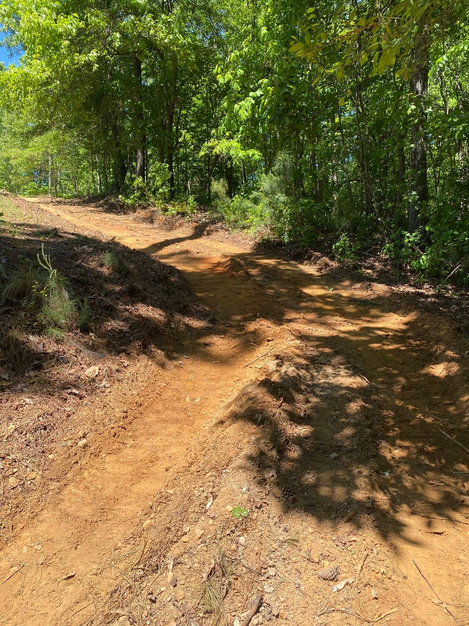
A drive in Varnell is often long and almost always on a grade, running back off Cleveland Highway, Prater Mill Road, Tunnel Hill Varnell Road, Cohutta Varnell Road, or one of the neighborhood streets like Nob North Drive, Highland Pointe Drive, or Meers Road. A drive on a grade has to be built as a water route first and a road second. Crown it so rain rolls off the edge within a few feet. Ditch the high shoulder so the hill above is not draining across the running surface. Then cut turnouts at intervals short enough that flow never builds up any real speed. Skip the turnouts and a long grade becomes a channel, and a channel takes the surface with it. That is what gravel driveway and access work looks like on a hill.
Pads on this ground want the same discipline. Grading and site prep sets the building up above the ground that gets wet, cuts and fills in compacted lifts, and shapes fall away on every side so nothing runs back against a wall. Where the cut is deeper than a pad, or where a spring or a seep has to be caught and carried away from a structure, excavation and dirt work and drainage and water control handle it together, because on a slope with a hard layer underneath, those are one job and not two.
Steep piece grown up in brush, a drive that washes out every spring, a hillside seep with no business being there? John is at (706) 936-4615 for a call or a text, and the quote form gets to him too. He walks the ground first. The price comes after.