Carrollton holds 23 square miles inside its limits, and the 2020 block count put 26,738 people and 10,466 houses on it. That is a lot of platted lot for a west Georgia town. It is also a lot of ground that was never platted at all, because the limits run well past the last curb in several directions and what sits out there is pasture, planted pine, and creek bottom with a Carrollton address. Legacy Land Care covers both halves of that. It is one man and his equipment, and the man who prices a job is the one who shows up to do it.
Davidson Is the Soil Under Most of This Town
Sample the ground inside the city limits and Davidson turns up more often than anything else, close to three points in ten. It is a red loam weathered off dark rock, the survey rates it well drained, and in the survey covering this county it also carries hydrologic group D. Group D is the highest runoff class the rating system has. Well drained and high runoff reads like a contradiction until you have stood on one during a storm. Water does not sit on Davidson. It leaves across the top, fast, and it takes the surface with it if nothing is holding the surface down.
Madison comes next at about a quarter of the town, and Madison is group B, which is a different animal on the same street. Hulett fills another eighth in group C. Three soils, three runoff ratings, one set of limit signs. Two lots four hundred feet apart can behave nothing alike here, and that is the reason a price that came off a map instead of off the property is usually wrong.
The mapping says one more useful thing about this town. The slopes are mild. Nothing in the sample rises above the 10 to 15 percent class and most of it sits between 2 and 10, with the whole city spread across roughly 250 feet of elevation from the low ground near 967 feet to the high side near 1,222. This is not hill country. It is long gentle fall over ground that sheds, and that combination moves a startling amount of water without ever looking dramatic while it does it.
An Eighth of the City Is Flood Plain
Chewacla silt loam, mapped on 0 to 2 percent slopes and described as frequently flooded, covers about an eighth of the ground inside the Carrollton limits. Flood plain soil, inside a city, on nearly no grade at all. That is not a defect in one unlucky property. It is what the bottom of this town is made of.
The reason is water volume. The Little Tallapoosa River runs close to seven miles inside these city limits and Buffalo Creek adds better than five more, with Curtis Creek and Buck Creek behind them. The subwatershed the town sits in is named Curtis Creek-Little Tallapoosa River, which is a fair description of the low end of Carrollton. Ground beside a channel that size does not only answer to its own rainfall. It answers to the river, and the water table under the nearby blocks rises and falls with it.
Practically, that splits the drainage question in two. On the Davidson and Madison uplands the trouble is water arriving too fast from uphill, and the answer is interception: a swale cut above the problem, a line laid with real fall, an outlet that actually releases somewhere instead of quitting in the middle of the lawn. Down on Chewacla the trouble is that there is no fall left to work with, and the honest answer is sometimes that a low field is behaving exactly as the valley intends. Sorting out which one you own is what drainage and water control starts with.
Town Lots and Edge Acreage Want Different Machines
Inside the grid, off Maple Street or Park Street or the blocks around Adamson Square, the work is small and finish oriented. A back corner that ponds. A yard the builder left rough. Ruts and a settled trench line. That is yard leveling, and on a city lot it is measured in inches and access points rather than acres. Where the machine comes in, what stays, and how close the work runs to a fence get settled before anything is unloaded.
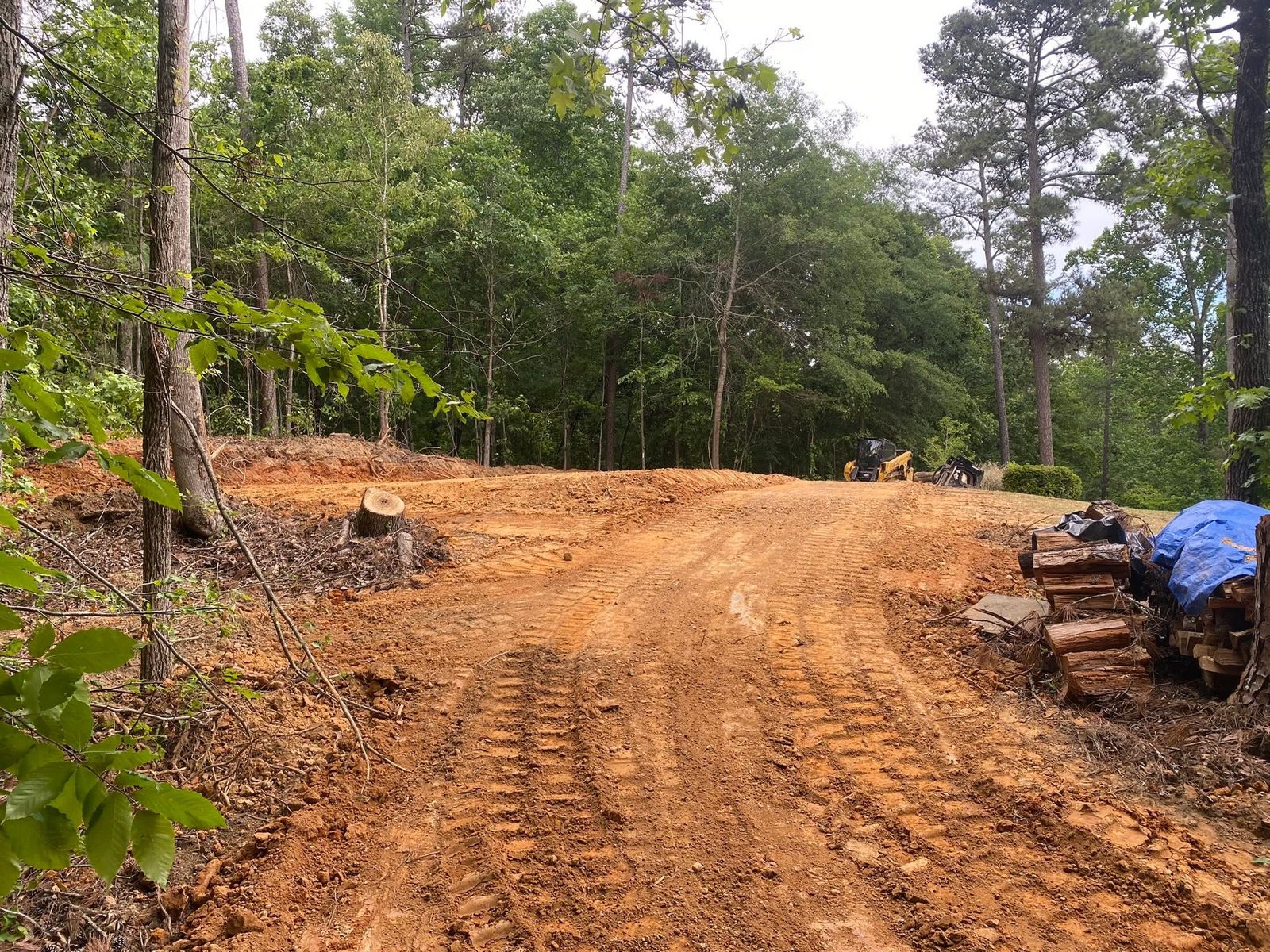
Out past the last streetlight the same address buys a different job. Fifteen acres of grown-up pasture on a Carrollton route is land clearing if a pad or a field is going on it and forestry mulching if the ground is staying as it is. Mulching earns its keep on this particular dirt because the chip layer and the root network are left intact, and on soil filed in the top runoff class that cover is the only thing between a bare field and a set of rills by March.
Six Routes Reach the Limits
US 27 runs the length of the city, US 27 Alternate carries the old Bankhead Highway alignment through it, and State Routes 16, 61, 113 and 166 all reach the limits. Bowdon Road heads southwest and Newnan Road heads southeast. Property with frontage on one of those has a public ditch or an inlet somewhere near it. Property a half mile behind one does not, and everything that lands on it has to be handled on the property itself.
That is where gravel drives and access work gets interesting around Carrollton, because the failure is rarely dramatic. On mild grade a drive does not blow out. It flattens, loses its crown a little at a time, and once the crown is gone the wheel tracks become the low point and start holding water instead of shedding it. Rebuilding one means putting the shape back and giving the water a place to leave at intervals, not adding depth on top of a surface that has already given up.
Building anything behind town starts with the pad. Grading and site prep cuts to firm material, places fill in lifts thin enough to bond, and sets the finished elevation high enough that a storm runs off the slab rather than toward it. Excavation and dirt work covers what it takes to get there: footings, hauling, spreading, and the odd access problem that comes with a long approach.
Overgrown lot inside the grid, or acreage on the edge of Carrollton that needs opening back up? Call or text John at (706) 936-4615, or send the details through the quote form. Nothing gets a number before he has stood on it.