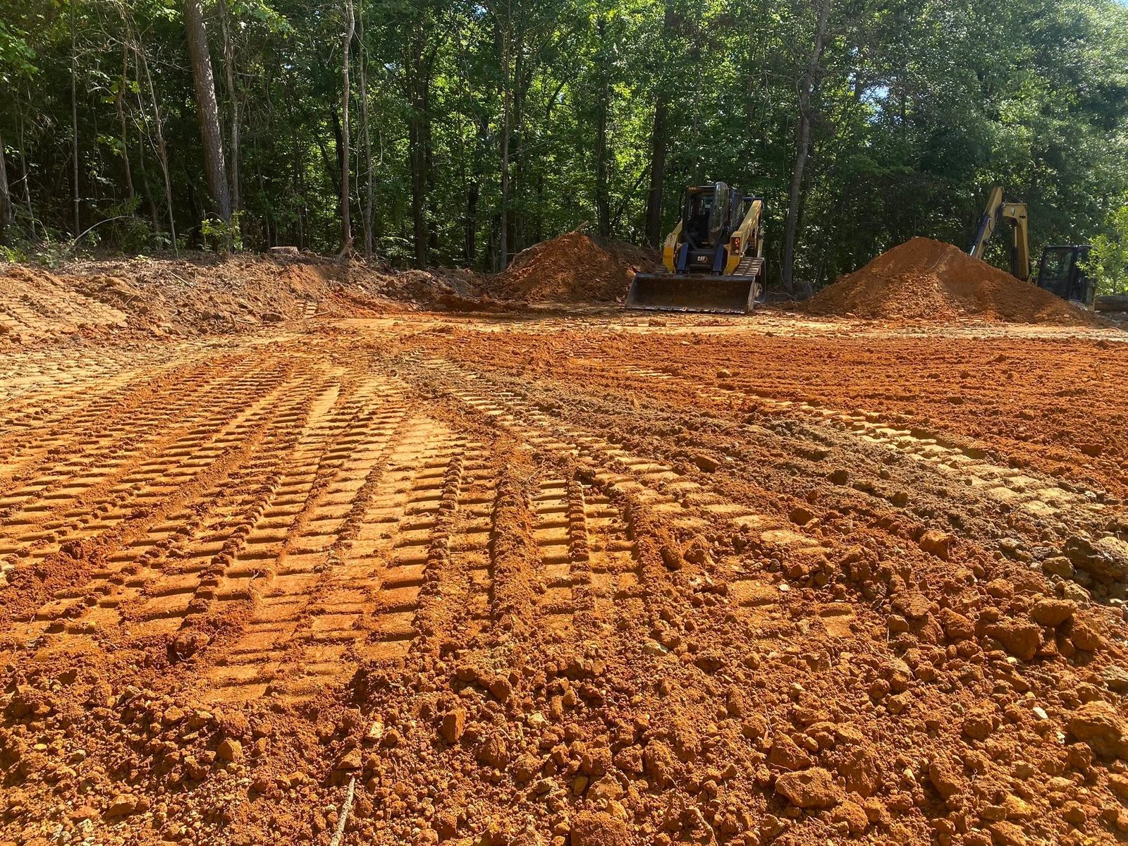
Paulding County occupies the northwest shoulder of the Georgia Piedmont, and it does not lie level. Hiram reads 978 feet. Dallas, five and a half miles northwest, reads 1,041. Yorkville, another nine miles west, stands at 1,355, which puts it 314 feet above the county seat. The western half of the county belongs to the Talladega Upland, the steeper and rougher edge of the Piedmont, and about 29 percent of Paulding falls inside it. Onto all of that comes 54.30 inches of rain a year, mostly onto clay weathered in place from schist and granite. Deep clay does not absorb rain so much as hand it along, and where the cover is gone the handing along starts carving.
Growth Has Not Reached Most of the 312 Square Miles
Dallas, Hiram, and the Paulding portion of Braswell are the only incorporated ground in the county, and there are no census designated places at all. The remaining 312 square miles is county road frontage, private lanes, and tracts running from three acres to three hundred. Rooftops have advanced a long way into that, so a fair share of the work here happens on a lot some mass grading operation already shaped once, but the parcels in between are still pasture, planted pine, and hardwood bottom.
Both situations share a problem the subdivision brochure leaves out. A lot delivered with the grading already decided has a finished surface somebody else chose, and nobody checked that choice against where the water actually wants to travel. A tract has no finished surface at all. Either way, runoff belongs to the person who owns the dirt it is crossing, all the way to the nearest branch. The access lane has to stay firm enough for a concrete truck. The well and the septic field both restrict where fill can be placed and which direction the final grade can fall. Those constraints get discovered by walking, not by reading a drawing.
Deep Red Clay With Rock Scattered Through It
Most of Paulding weathered from schist, phyllite, and granite. Rion is the largest single soil in the county at about 30,600 acres, roughly 15.7 percent of the total, and Rion is deep and well drained and about as cooperative as this ground gets. Pacolet, Lloyd, and Grover behave similarly. Fruithurst and Braswell are the fine grained metamorphic soils, formed on sericite schist and phyllite, deep enough to work but slick underfoot when wet. The Braswell series carries a local footnote: it was proposed here in 2010, and it shares a name with the town on the Polk County line.
The complication is that the shallow soils are not gathered into a band you can steer around. They are salted through the deep ones. Wilkes reaches weathered rock at about fourteen inches, Sunlight and Tallapoosa at about fifteen, Musella at sixteen. All of them favor the steeper faces, which is precisely where a pad benches in and a lane climbs. Poindexter and Wateree hold out to roughly thirty inches and Mountain Park to about thirty two, so plenty of ground offers a bench and then quits partway through it.
The bottoms are a separate case again. Cartecay lies on flood plains at 0 to 3 percent and Chewacla at 0 to 2, and the survey rates both somewhat poorly drained. Toccoa sits alongside them in the lowest runoff class the county has. Two soils within sight of each other, opposite instructions.
Three Watersheds and Two Bays
The divides here run through the middle of the county, and they do more than move a line on a map. About 60 percent of Paulding drains north by Pumpkinvine Creek to the Etowah. Roughly 28 percent, the south and southeast around Hiram, goes to Sweetwater Creek and on to the Chattahoochee. The last 12 percent, out on the southwest, belongs to the Upper Tallapoosa. Etowah and Tallapoosa water reaches salt water at Mobile Bay by way of the Alabama River. Chattahoochee water reaches it at Apalachicola Bay. One county, two coastlines.
On the ground that means two properties half a mile apart can be aimed at different creeks, which decides where a ditch or a pipe has any legitimate discharge. Pumpkinvine, at 47.3 kilometers the longest stream inside the boundary, collects the north half through Little Pumpkinvine, Possum Creek, and Picketts Mill Creek, all of them running in narrow bottoms with real fall above. Raccoon Creek performs the same duty on the west side. Sweetwater begins as small branches on the south end, so yards down that way often sit above a drainage that hardly looks like one until a storm proves otherwise.
Slope closes the argument. Tallapoosa, Musella, and Wilkes hold the highest runoff rating in the county, and not one of them is a wet soil. They shed because rock is near the surface and water has nowhere to go but across. That is how a hillside can be dust dry in August and cut a gully in a single November storm. The Dallas 7 NE record puts March at 5.14 inches, February at 5.11, December at 5.00, and January at 4.90, against 3.40 in October, so the heaviest months arrive when the clay is already full.
Choosing the Right Work for the Slope
Begin with fall, not with footprint. When a shop or a barn is going onto a Paulding hillside, the governing question is what the ground above it will send down, and grading and site prep answers it: bench the pad, carry fall away from every corner, and turn the upslope flow aside before it arrives. Filling a low area without answering that simply moves the standing water a short distance.
Long private lanes fail here in a recognizable sequence. No crown, so the running surface ponds. No functioning ditch, so the shoulder ponds too. Nothing shedding flow off the alignment, so a quarter mile of road becomes a quarter mile of stream. A gravel drive built to shed takes the same weather without shifting. Where the route crosses one of those unnamed branches, the pipe gets sized for the flow that shows up, not for what looks neat.
Soft ground gets identified before it gets excavated. Softness near a bottom is usually flood plain soil sitting flat, and that wants a discharge with somewhere lower to reach. Softness partway up a slope is usually inflow from above, and that wants interception higher on the hill. Drainage and water control covers two different jobs under a single heading, and choosing wrong is the ordinary way to pay for it twice.
On ground that has grown up, land clearing takes stumps and root systems off a site that is about to carry something, and what follows the clearing matters more here than the clearing itself. Exposed Piedmont clay on a steep face will not wait around for grass to volunteer. Cover goes back on quickly, or the slope leaves.
For property outside Dallas, Hiram, and Braswell, out around New Georgia, New Hope, Union, or Yorkville, call or text John at (706) 936-4615 or write up the job in the quote form. Pricing comes after the visit.