Weiss Lake sets the terms in Cherokee County. The Coosa River is impounded at the west end of the county and the pool stands at 559 feet, while Weisner Mountain rises to 1,884 feet on the far side of the same county line. The Census counts 46.36 square miles of surface water here, which is 7.7 percent of everything inside the boundary. Shoreline is not a feature of this county. It is the shape of it.
Seven Limit Signs and 553 Square Miles of Dry Land
Cedar Bluff, Centre, Collinsville, Gaylesville, Leesburg, Piedmont, and Sand Rock all cross into Cherokee County. Together they still leave the large share of 553 square miles of land under no town at all, and that remainder is who this page is written for. A steep lot dropping to the water below Leesburg. Sixty acres of Broomtown Valley grown up in privet since the last time anything grazed it. A cabin lane running back off a county road with no shoulder and no pipe under it.
Two things change once the pavement ends. Whatever falls on your ground stays your problem all the way to the nearest branch or the lake, because no gutter and no storm drain is standing by at the line to take it off your hands. And the lane is the whole delivery system, since gravel trucks, well rigs, propane, and concrete all ride in on whatever you built.
Shale in the Bottoms, Chert on the Benches, Sandstone Up Top
The survey maps 384,150 acres in this county and calls 28,528 of them water. What is left pulls in opposite directions. Minvale, roughly 39,500 acres, is colluvium washed off cherty limestone and it drains well. Conasauga sits right beside it at roughly 39,400 acres, and Conasauga is shale residuum rated in the highest runoff class with soft rock waiting near 30 inches. Firestone adds another 29,100 acres of very fine shrink-swell clay that sheds water the same way.
Chert is the other half of the story. Bodine covers about 16,600 acres and takes water in faster than any soil in the county, which sounds like a gift until the bucket comes up full of flint-hard gravel instead of dirt. Hartsells runs about 19,800 acres on the sandstone with rock at roughly three feet, and out at Sand Rock the county climbs onto the plateau entirely, where the Level IV ecoregion changes from valley to table plateau in the space of a few road miles. Down on the lake flats and the creek bottoms, Gaylesville soil lies on zero to two percent slope, rated somewhat poorly drained, and it earns that rating.
Ninety Three Percent of the County Runs to the Upper Coosa
Sample the county against the USGS watershed boundaries and 93.1 percent of it falls in the Upper Coosa subbasin, with the last 6.9 percent in Middle Coosa. There is no second direction. Everything here ends in one river, and most of it reaches the lake before it gets there.
The named channels are worth knowing apart. The Coosa carries about 31 miles of mapped channel inside the county. Terrapin Creek adds 23, Spring Creek 22, Mills Creek 21, and Little River 21. The Chattooga River crosses in from Georgia and runs about 19 more before the lake takes it, and that is the northwest Georgia river of the name, not the whitewater Chattooga off on the South Carolina border. Weiss Lake itself maps just under 40 square miles of surface, and nothing else in the county reaches a quarter of a square mile.
The gauge at Centre averages 57.08 inches a year at 59.7 degrees. March leads at 5.62 inches, then February at 5.54, December at 5.32, and January at 5.19. October is the dry month at 3.64. The heaviest rain lands on the coldest, softest ground, which is why so much winter work on this side of the state turns into water work whether anybody planned it that way or not.
What Lake Ground Asks For
Ground that falls toward water rewards planning and punishes guessing. Strip a slope above the lake and the next hard rain relocates what used to be held down, so on anything steep enough to matter forestry mulching is the safer opening move: the standing growth is ground off, and the mulch plus the live roots underneath are left holding the bank. Where the fall is gentle and the goal is pasture or a homesite rather than a screen of trees, land clearing takes out stumps and root balls so nothing surfaces later under a slab or a rotary cutter.
Wet ground is its own line of work here, not an afterthought. Gaylesville and Chewacla both sit on almost no slope with a somewhat poorly drained rating, and no amount of fill turns that into dry ground. What works is an outlet, cut so water has a place to go, and interception uphill so less of it arrives in the first place. That is what drainage and water control is for, and on this county's shale soils it usually has to come before anything else is worth doing.
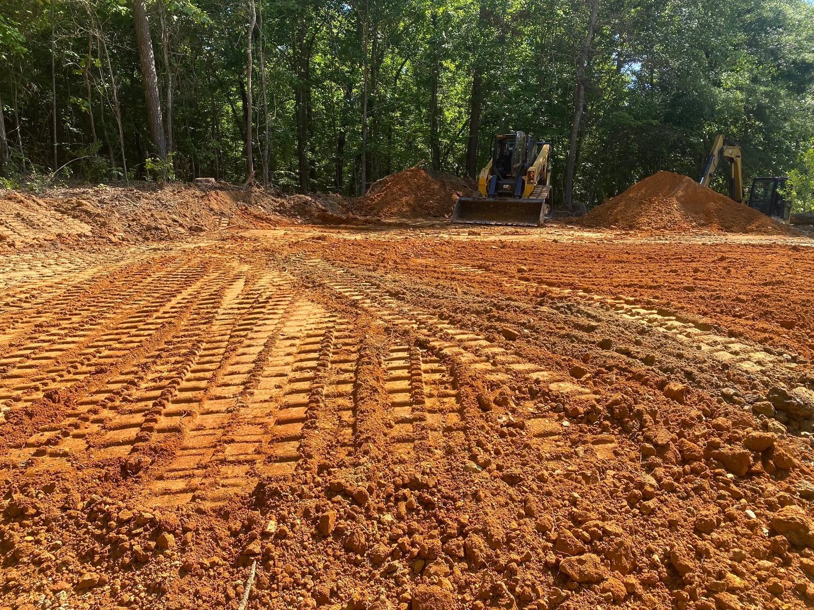
Building pads follow from the same reading. Set high, shaped to fall away on all four sides, with whatever comes down the hill above caught before it reaches a wall: that is grading and site prep done for ground that gets 57 inches a year. On the chert benches expect rock in the bucket and plan the cut around it. On hunting and recreational tracts back off the water, the work is usually lanes, plots, and getting a truck to the back of the property without cutting a gully on the way.
If your place is outside Centre, Cedar Bluff, Leesburg, Gaylesville, or Sand Rock, John Mulkey will come look at it and tell you what it is going to do. Call or text (706) 936-4615, or send the details through the quote form. Nothing gets priced from a satellite photo.